2008-10-21
…There might be one near you. Get involved in shutting it down!
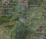
Researchers from TNI and other institutions have mapped more than 800 bases onto google earth. Now you can for the first time see the global reach of foreign military bases from outer space and then zoom in close for aerial shots of key bases such as US base Guantanamo Bay in Cuba.
In March 2007, TNI revealed some of the human and environmental costs of the thousands of military bases in its report, Outposts of Empire: The case against foreign military bases. Now you can for the first time see the global reach of foreign military bases from outer space and then zoom in close for aerial shots of key bases such as US base Guantanamo Bay in Cuba, Nato Headquarters in Skopje Macedonia, or the imposing number of US bases on the small island of Okinawa, Japan.
Researchers from US universities, NGOs Transnational Institute and Fellowship of Reconciliation used official sources, security websites, and private research to map more than 800 bases in more than 60 countries. The US has by far the largest number of bases, but French, British, German, Russian, as well as joint international bases such as NATO and EUFOR bases have all been mapped.
The resulting Google Earth programme is a striking visualisation of the extent to which foreign military bases in the 21st Century reach right across the globe. It also points to why there is growing community resistance against military bases from Greenland to French Polynesia, Paraguay to Korea, which has crystallised into a powerful global movement (www.no-bases.org).
For security reasons, countries often do not provide detailed information on the exact locations of their foreign military bases and installations. As a result, the map is still far from complete. However it is hoped that the map will evolve and improve in the coming months with the help of activist and researcher’s inputs from all over the globe. Help us improve and expand the map by checking the position of a base near you and send us a mail with corrections or additions using this form
Credits: The project of mapping bases was initiated by John Lindsay-Poland, Ethan Flad and Brian McAdoo expanding on map work pioneered by Zoltan Grossman at Evergreen State College in Washington (See Fellowship magazine, Winter 2007 issue (Vol. 73, no. 1-3, www.forusa.org). The work was built on by TNI intern, Lena Strunk using data which is cited for each base.